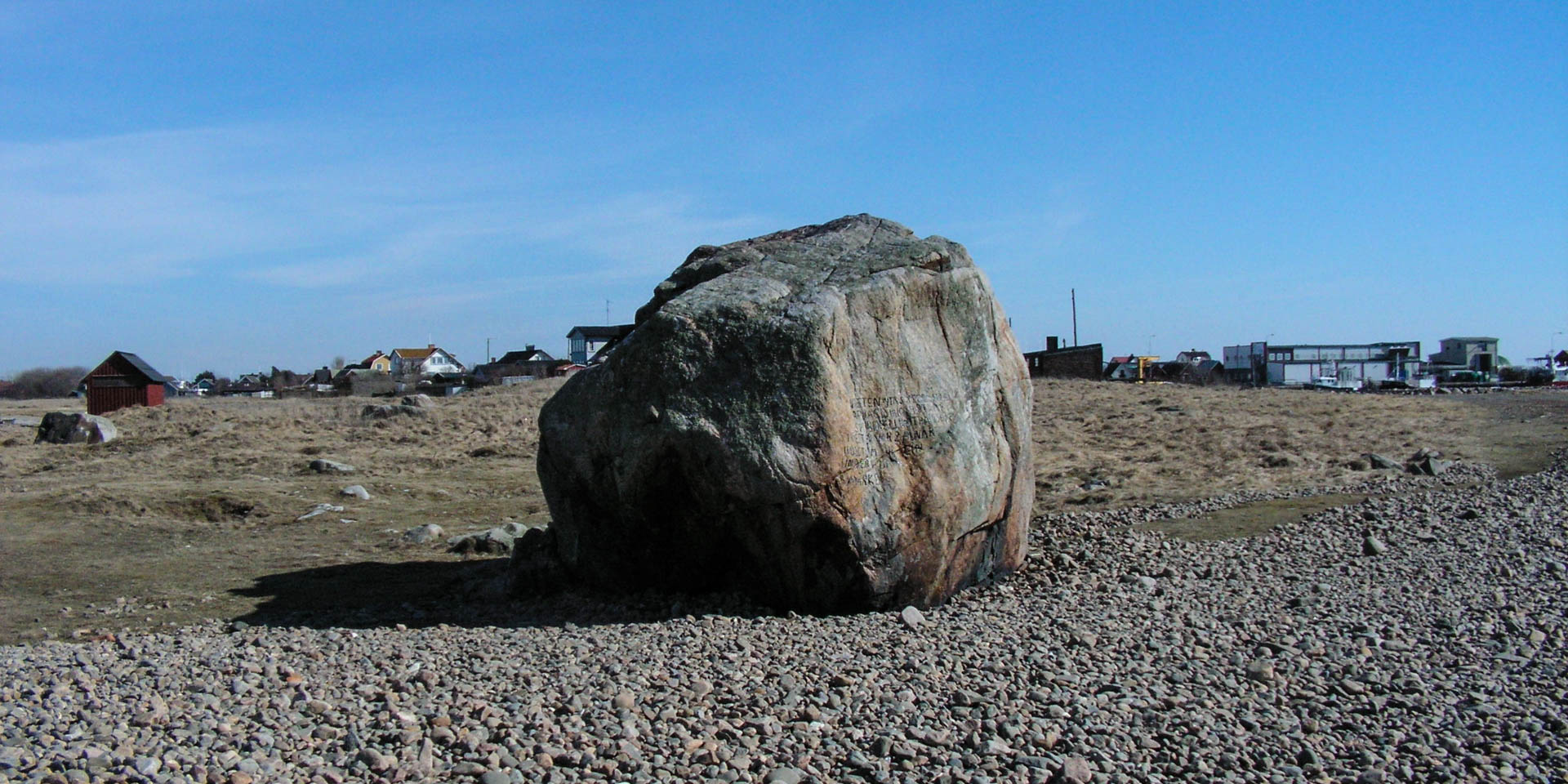

Glomstenen
Great boulder in Glommen
Glomstenen is a well-known boulder in the nature reserve Morups Tånge on a promontory on the outskirts of Glommen, about ten kilometres northwest of Falkenberg.
The Glomstenen is a real boulder, a huge rock that was transported by an ice age glacier and was unloaded at the end of the last ice age at the tip of the rocky promontory that extends far into the sea.
In former times the well visible rock served as a navigation mark and is already mentioned in the reports about the war trip of King Harald Hårdrådes in the years 1061/62 as well as the campaign of King Håkon Håkonsson against Halland in the 1250s. Until modern times, more precisely until the installation of a lighthouse in 1843, the Glomstenen was mainly used by local fishermen as an orientation when sailing around the dangerous reef.
The Glomstenen as a scientific instrument
A special feature of the stone is an inscription dating from 1816. It is an explanatory text and the marking of the average water level of the Kattegat at that time, which Professor Sven Peter Bexell recorded there with 1,528 millimetres in order to measure changes in the water level.
The background to the marking was the scientific discussions that arose in the 18th century about the reduction in water levels on the Swedish coasts that had been noticed for centuries. Already during the lifetime of Anders Celsius (1701–1744), the water levels were marked at his suggestion on rocks along the Swedish coasts in order to trace the phenomenon.
The Fennoscandian uplift
It was not until the 19th century that the final explanation was found for the permanently decreasing water levels, the Fennoscandian uplift, which has continued since the end of the last ice age. After the melting of the up to 3,000 metre thick ice shield in Scandinavia, the land mass continues to rise permanently due to the relief. In southern Sweden the land elevation is just under one millimetre per year, but in northern Sweden it is up to nine millimetres per year, which on the east coast of Sweden has often in the course of history led to seaports and rivers becoming unusable for maritime navigation due to the decreasing water depths.