
Vetteberget
Fjällbacka's peak
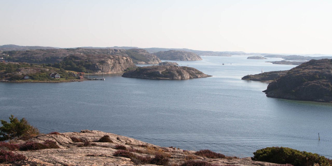
The 74-metre-high Vetteberget is the widely visible landmark of the popular holiday resort Fjällbacka in the south of the municipality of Tanum. From its summit it offers a fantastic view of the island archipelago off the rocky coast of the historic province of Bohuslän.
The Vetteberget is named after its function as an ancient maritime landmark, as evidenced today by a large cairn and the knowledge of beacons on its summit in the 10th century. The name derives from the old Norse word "viti" for sign, which then became "vedde" for sea sign.
Vetteberget and Fjällbacka
The name Fjällbacka is also directly related to Vetteberget. The inhabitants of the picturesque village do not live behind the moon, but literally behind the mountain, because Fjällbacka means translated "on the back (bak) of the mountain (Fjäll)". This is unmistakably true for the original part of the village, where the houses, seen from the land side, crowd behind the mountain, on the narrow strip between the shore line and the steep cliffs of the Vetteberget.
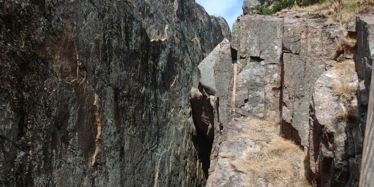
The Vetteberget consists of two unequal parts – the large Stora Vetteberget and the comparatively very small Lilla Vetteberget. The two parts of the rock massif are separated by the deep and 200 meter long crevice Kungsklyfta, which by the way also served as a backdrop in the film adaptation of Astrid Lindgren's Ronia, the Robber's Daughter.
Explore the Vetteberget
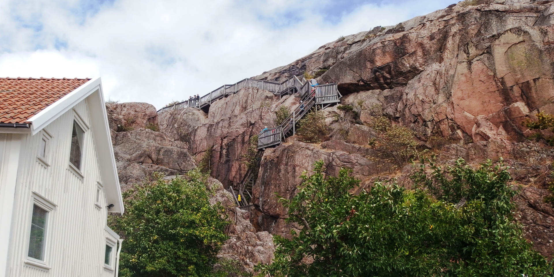
Several paths lead up the mountain, of which the following two are the most frequently used. The most exciting but also more challenging path starts at Ingrid Bergman Torg and leads over loose rock through the ascending Kungsklyfta to the stairs at the southern end of the gorge, whose numerous steps lead to the summit.
If the path through the Kungsklyfta is too difficult, approach the mountain from the south side and reach the steps without crossing the gorge. In any case, the efforts of the climb to the top are rewarded by a magnificent circular panorama. The view extends over the village with its colourful hustle and bustle in the picturesque alleys and the lively harbour, far beyond the sea and the countless rocky islands of the archipelago. With extremely good visibility, you can even see the silhouette of the northern tip of Denmark.
At the lookout point there are also some signs indicating the direction to various distant places. For a longer break, there are seats and picnic tables available and there is nothing to stop you from watching the romantic play of colours of the sun sinking into the sea in the evening.
For the way back, you can either take the same path you came or take the marked circular trail Vettebergleden, which leads over the mountain and down to the village at various points. The longest section, with a length of 1.3 kilometres, leads from the viewpoint first in a south-easterly direction and leaves the mountain on its eastern side near the local history museum Nestorsgården.